Monday, 1 October 2018

A Cyprus sandwich with a Lebanon filling Sat 29th

Today will be mountains, castles, whirling in Nicosia and a foodie harbour.


Mountains first. This is the back or south side of the Kyrenia Range. The mountain above is called Besparmac which means five fingers and from the north side looks like a clenched fist showing five knuckles.


There is a tragic story behind the TRNC flag laid out in stone on the mountain above. It is to commemorate the men of Tashkent village, all of whom were killed in the massacres leading up to 1974. The women left without their breadwinning menfolk, went into egg production to gain a livelihood. The area is still famous for its eggs.


 A massive 3000 kneeler capacity mosque on the outskirts of Nicosia. Erdogan was present at the opening ceremony, but many see the building of schools and hospitals a bigger priority for Turkish money.


Here we are inside the restored Buyuk Han or Great Inn. Built in 1572 the year after the Otterman Empire took Cyprus, it was the Hilton of its day.  Now you can buy souvenirs and have a drink, if you are prepared to wait long enough.


 Next some reflections of the British presence, who vacated the island (well nearly) in 1960. Above the attractive colonial style Court House, still fulfilling its judicial function. Spot the lion and unicorn. Below is the Post Office.


And a Post Office is no good without some letterboxes.


Now here's a mystery. What's a Peruvian woman doing standing in the middle of a gothic Christian Cathedral that is masquerading as a Mosque? Well the answer is that it's Helen in mosque mufti. The Cathedral was Catholic and dedicated to St Sophia in 1209. The magnificent west window is behind Helen and the whitewash enhances the beauty of the building. It became the main mosque for Nicosia after the invasion of 1571. A purpose it still fulfills today over 400 years later. The carpet pattern which is not square with the building is orientated towards Mecca. It has a particularly fine triple portico that is reminiscent of Peterborough Cathedral.


You will all have heard of them, now you can see them. This is the real McWhirl, by which I mean a pair of whirling dervishes actually whirling. Part prayer, part trance but not a performance or dance. I found the experience fascinating and somewhat mesmerizing. They gave at least four different turns, as it were, and the whole thing lasted about half an hour.


The same activity captured in bronze.


In a lighter spirit I pictured these to illustrate how important packaging is in the drinks and perfumery industries.


More seriously here we can see the buffer zone that still exists on the border through Nicosia.


After a little discussion with the local police about traffic management in the city, we head off north to Kyrenia. We recross the mountain chain a little further west and drive up the highest prominence. Where else would you build your castle? This is St Hilarion Castle, built originally in the C11 by the Byzantines. The castle has seen constant use through the centuries, indeed the Turkish army has only recently stopped using it and they are very active around it.


The view of Kyrenia from the top is spectacular.


And zooming in a little you can pick out the details. Kyrenia castle and old harbour are in the middle of this picture, and this is where we are heading for next.


On the way down I took this photo of the soldiers guarding the entrance to their camp.


This is the old harbour of Kyrenia. Once a very important trading port, now more of a marina and base for the day tripping boats. What were once warehouses for the carob beans are now rather splendid restaurants.


 By the time we had finished our meal, the sun had set and we enjoyed this final view of the harbour.


Sunday, 30 September 2018

A Cyprus sandwich with a Lebanon filling. Friday 28th October

In marked contrast to our last trip down to Luton airport, this one went very smoothly apart from the now familiar wrestling match between the sat nav and the geography. We did however arrive at Slip End where the car parking is, albeit from the opposite direction. There was a slight delay in take off when an absentee passenger's suitcase was removed from the hold. Good thinking, I thought.
Anne and David were there to meet us at Larnaca arrivals and we were soon on our way. Larnaca is,of course in the south, ie Greek Cyprus. After about twenty minutes we had to cross the border into the North. A serious formal border with rigorous checking of the kind that we don't encounter within the EU, but we will now have to get used to again. The contrast between the two sides is immediate and stark. Another thirty minutes drive and a stop for a meal before we arrive at the accommodation that Anne and David have arranged for us. They have lived most of the year over here for the past 12 years and have had various villas and apartments over the years.
This development contains 8 blocks of 5 apartments each with a shared 25 metre pool and gym. All in all a very nice facility. Let's have a look around.


Above you can see 4 of the blocks, the pool and the gym along with the landscaped gardens which is a common area.


The pool was easy entry, without that mild shock to the system you often get.


Our bedroom on the mezanine level,the right over the ledge looks down to our lounge, sea view and patio, as the picture below shows. Below the bedroom and bathroom is the kitchen, second bedroom and another bathroom.


The lounge and dining area.


Friday's trip out involved following the north coast towards the Karpass "pan handle" peninsula. Much of the time the beaches are pebbley but there are nice sandy coves which are almost completely deserted.


The bedrock is a rather soft sandstone which is eroded by the wind and rain into weird fantastic shapes, where with an active imagination you can create anything.


A closer view of the Daliesque images.


We drove south across the Karpass peninsula to the little fishing port of Bogaz. You can see the winches attached to the bows of the fishing boats to haul the nets in with.


Quality of the composition betrays the professional competencey of the photographer that I hired to take this group shot. If you zoomed the camera lens enough, you would eventually see a beach on the coast of Lebanon.


We drove on further south towards Famagusta to explore the ruins of the site of Salamis. The history of this large site goes back to the C11 BCE when it is thought that people from Enkomi came here after the earthquake of 1075 BCE. Coins were first minted here in the C6 when the area came under the rule of the Persian Empire. Alexander the Great marched in during the C4 and following his death it became part of Ptolemy's empire. Hellenic followed by Roman invasions were to come next and finally the Byzantine emperor Constantius arrived and eponymously renamed it. Most of what you see today comes from the Roman period either side of the BCE/CE divide.


Above, the columnaded square is a gymnasium and baths complex. All the things you would expect to see are here. Cold rooms, sweat rooms, stroking rooms and 5 star decoration, like the mosaic below.


A nice example of a hypocaust system.


Next was a scruffy field with rocks in that was billed as the Amphitheatre so we walked swiftly on to the theatre as you can see below. Incidentally can you spot the dramatic photographer in the theatre.


The complete site is pretty huge and really needs some transport assistance to allow visitors a comprehensive overview. The site is crying out for some decent interpretation, better signage, proper paths that don't resemble goat tracks and best of all, multilingual audioguides. This is a fabulous site that deserves recognition as a world heritage site but won't get near to it until it improves its act.
Things we didn't see included two basilicas, the Forum, a villa or two, the Temple of Zeus and a very sophisticated reservoir and aqueduct. Below is a roman street.


Time to move on to Famagusta. This city is famous for its no go zone. Most of the city still functions including the medieval walled city but there is a large zone which was under Greek title which has been unoccupied since 1973. Or has it?
We are enjoying a drink in the smart hotel from whoes terrace I took these pictures. At the end of the sun loungers the beach is closed with a military checkpoint preventing anyone from going any further. The three towers are former hotels and are in ruins. This situation is the same all the way round until the white hotel you can see immediately above the couple on the shoreline.


But what's this in the middle of the empty zone? A Turkish and a TRNC flag flying.


A slightly closer view of the empty buildings.


A superzoom shot of the beach in front of the building with the flags reveals lights on and people on the beach.


Meanwhile the band plays on at our end, but not "Nearer My God to Thee" I trust.


So after a lovely day, it was back to the ranch and out to the restaurant to eat.

Friday, 28 September 2018

A Cyprus Sandwich with Lebanon Filling. The plan.

We are planning to visit two troubled countries with a history of conflict and both have had a "green line" to separate the warring parties.
Officially known as the Turkish Republic of Northern Cyprus, this country, which occupies the North East third of the island of Cyprus is only recognised by Turkey and will be our first port of call. We have friends, David and Anne who live there for a lot of the year and will be hosting our stay.
A coup d'etat in 1974 resulted in an attempt to annex the island to Greece and prompted the Turkish invasion. This resulted in the eviction of much of the north's Greek Cypriot population, the flight of the Turkish Cypriots from the south and the partitioning of the island. A unilateral declaration of independence was declared by the North in 1983. Subsequent to this a large number of Turkish citizens moved to the island, to say nothing of the presence of thousands of Turkish soldiers who remain stationed on the island.


This map shows the divided island. Good quiz question here, which city is capital of more than one country? Answer, Nicosia albeit that TRNC is not recognised by anyone except Turkey.
After a few days in Cyprus, David and Anne will join us on the 45 minute flight to Beirut where with benefit of a hire car, we will spend a few days exploring Lebanon.
This is another country with a chequered  history.


As you can see Lebanon is surrounded by the Mediterranean Sea to the west and Syria all round except for the border in the south, with Israel and the occupied Golan Heights. A very brief recent history of Lebanon goes as follows. 1920 Lebanon is placed under a League of Nations mandate having been under French control since the First World War and previous to that a part of the Otterman Empire since the C16. In 1923 a Constitution is drawn up and the Republic of Lebanon was declared. The unwritten National Pact of 1943 required that its president be Maronite Christian, its speaker of the parliament to be a Shiite Muslim, its prime minister be Sunni Muslim, and the Deputy Speaker of Parliament and the Deputy Prime Minister be Greek Orthodox. This power sharing arrangement survives to this day.There seems to be no period of the C20 when the Lebanon was free from strife. The civil war lasted from 1975 until 1990. A conflict between Christians and Muslims in their various guises, complicated by the cold war, Syrian and Isreali involvement and the presence of the PLO and Hezbollah. Syrian occupation was to continue from 1992 up until 2005. Life has not really been much easier since with endemic tensions that are seemingly irresolvable. The Syrian civil war has led to a huge influx of refugees. The population of Lebanon was about 6 million in 2015, since then the have accepted one million refugees from Syria, a unprecedented humanitarian gesture, especially when compared with the UK's reluctant acceptance of ten thousand refugees from the entire world in same time period. There is, of course the ever present Palastinian / Isreali conflict.
How all these things affect everyday life, we shall see and I will endeavour to report through this blog.

Sunday, 10 June 2018

A Greek Odyssey The delights of Aegina 10th June 2018

Probably the best place to start is with a map of the island.


We are staying on the north coast that looks across directly across to the Peloponnese peninsula and Athens if you look a little to the east. Our location is Vagiia. Just to the south of us, dominating the hillside between us and Aegina Marina is the Temple of Aphasia. (The spellings here, even in the roman alphabet are a movable feast).

It was excavated in 1811 and the best sculpture removed for auction. It was bought by (Mad) King Ludwig of Bavaria. They now reside in a Munich museum. So, Lord Elgin, you're not the only one.


The temple was constructed in 580 BCE. Apparently this temple, the Parthenon and the Temple of Poseidon at Sounion form an equilateral triangle. Whether this is design or accident isn't mentioned in the books.


A view of the South East end of the island which is not inhabited and consequently has no infrastructure.


Paliachora or Old Town is a fascinating visit. This is now a ghost town with the ruins of about 40 churches remaining from what was a total of 365.
For nearly a thousand years the population of Aegina lived on this precipitous hillside with a citadel at the very top. The reason they packed their bags and moved up the hill was for self defence. Living on the coast they were sitting ducks for the Saracen pirate raids so in 896 CE, up they went. The churches were built of the rock from the hill and the homes were low and earth coloured. Invisibility was the intention. The raids continued over the centuries with 1537 being a particularly disasterous year when Suleiman the Magnificent ordered the pirate Barbarossa to attack. All the male population were killed and the women raped then, with the children taken into slavery. In the early 1820s with the War of Independence the town was briefly the capital of Greece. With some semblance of peace restored, the locals moved back to the coast and the town was abandoned.


Looking up toward the citadel. You can just make out the ruins of the surviving churches if you expand the picture.


A few of the churches still have original frescoes in them. It's hard to be sure of the dates but I guess these pictured are C14.


Further details of the frescoes.


This was a really great visit,  though at times a strenuous climb. In a very different way I had visions of Ani, that other ghost city on the old silk road.
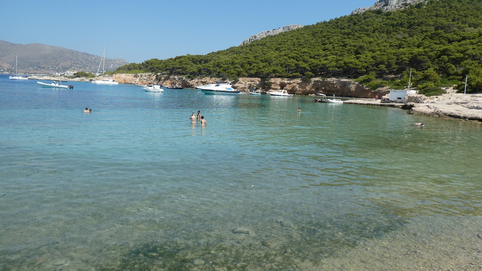
We drove down to the little fishing port of Perdika on the South Western tip where we took a boat to the uninhabited island of Moni. In the first picture below we are leaving the port,


then here we are on the island. Apart from thousands of sea birds Moni has a resident population of wild deer and not so wild peacocks.


You can also sunbathe there.


We enjoyed a really good night out with a very nice couple, Brian and Jo who were saying at the Beachhouse. This was in Aegina Marina. The picture incidentally was taken by a Polish film producer who Helen persuaded to use his talents on us.


The fish market in Aegina, though not busy as it was Sunday.


A final shot on our last evening at Aegina.